Last week I tried one of the thirty-two web 2.0 applications listed on Larry Ferlazzo's The Best Web 2.0 Applications For Education In 2013---So Far called Buncee. It's best described as a tool for creating slides incorporating multi-media such as images, videos, text, drawings and audio. My review and step-by-step walk-through is embedded in the name above.
Another of the applications referenced in this list is Mosey. According to the site:
Our Service allows users to create, view, and explore “Moseys,” which are custom, curated adventures for various locations around the world. Through Moseys, users can share with others their thoughts, notes, experiences, recommendations, reviews, instructions, and other information to piece together an adventure in a given place or location for other users to enjoy.
In making a Mosey you can document a single day or an entire trip. What you do create is meant to be shared with others. This application is web-based; meaning it will work on all devices. You have the ability to search other Mosey creations. Basic use is free for those 13 years or older.
After clicking the Sign Up button you are taken to a new window where you can register using your Facebook account or create a separate account. You begin by entering in your email address and a password. You continue by creating a profile with your first and last name and city. (A welcoming email is sent to your inbox immediately.)
 At the next screen you are invited to update your profile by adding a picture, user handle, short bio and gender. You can decide what to add or not. In the upper right-hand corner are options for use. The first is Explore.
 You can search by Moseys, Places or People. On the right-hand side of this page is a search box for entering in keywords, a list of popular categories (Arts+Culture, Outdoors, Shopping, Scenic, Drinks, Foodie, Nightlife) along with filters, Most Recent, Most Popular, Featured and Friends. I scrolled through nearly 200 of the previously created Moseys looking for any which might be inappropriate for users 13 years or older. At this time I did not see any based upon the title of the Moseys. Most featured scenic vistas and food.

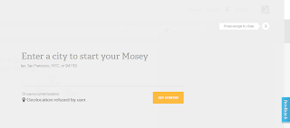
Next I selected the Create button. Initially you are asked if Mosey can access your Geolocation via your computer. Thinking of this application in the educational setting (erring on the side of caution) I refused. This working screen appears to be an overlay on the original screen. I entered in my location (place name or zip code) and clicked the Get Started button.
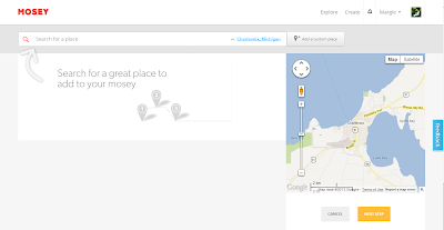
 At the following window you are asked to search for a place in your location or add a custom place. On the right is a map pinpointing your place of origin. When you wish to add a photo it comes from images already in Moseys. At this point I am unable to add my own images. (There must be a way of doing this.)
You can keep adding places by entering new names into the search bar. When you have all the spots you wish to include, select the Next Step button. The following screen is for creating your cover image and title.
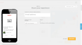
 The lines for entering in a title and description are available. But the Select a cover image was not. After choosing Next Step you are asked to pick as many appropriate categories that fit your Mosey and estimate the cost for this Mosey. At the third step you can share this Mosey via email or on Facebook or choose to make it private. You can still go back to edit the last three steps before clicking the Finish button.
Upon clicking the Finish button an email is sent to you announcing the completion of your Mosey. The site has filled in images for each of your selected spots. Your screen will look like the image below. Beneath this are each of the designated places with images (if available) for each. At this time I have still not been able to determine how to replace the stock (public) images with my own. Even choosing the edit button does not remedy this.
Above each specific location is an icon of a walking person. When you click on that a new window opens giving you pictorial and written walking directions to get to that place from your current location. This is a huge benefit.
When you choose the Share button next to the Edit button at the top of your Mosey, you can post it to your Facebook wall, send a message via Facebook, send a tweet on Twitter or post it on Pinterest. At this time there is no Help section other then sending in a message via the Feedback tab or using email contacts listed at the bottom of the page. I have sent in an inquiry as to using your own images. UPDATE: I have received a reply. They are working on you using your own images as well as being able to embed your Mosey using HTML code. Great news!
I can see an advantage to using this in the classroom in a variety of situations. In our curriculum we study our community at the earlier grade levels. It would be a great tool for the older students to use to create important places in the town for the younger students to explore on a walking trip. Both would benefit from the experience. It could be used to document the exploration of other geographical places in the study of history or current events. Students can plan the trip of their dreams or a trip their favorite character from a book might want to take. For those books read where characters travel, this tool could track that trip.
Mosey is exceedingly user-friendly. The ease of use is exemplary. I will update this post as soon as I receive a reply as to the images. Hopefully I have missed the obvious. I believe Mosey has a place in the educational setting.
This is the link to my created Mosey, My Favorite Places in Charlevoix.


No comments:
Post a Comment